Address
Studio 03
SUM Studios
1 Hartley Street
Sheffield
S2 3AQ
[email protected]
0114 399 1023

Interested in learning more about point cloud surveys but not sure where to start? This comprehensive guide covers everything you need to know about a point cloud survey, from A to Z. Read on to learn about what exactly a point cloud survey is, what a laser scanner does, the different benefits, use cases, and file types a point cloud can be converted into, and the factors that determine point cloud survey cost.
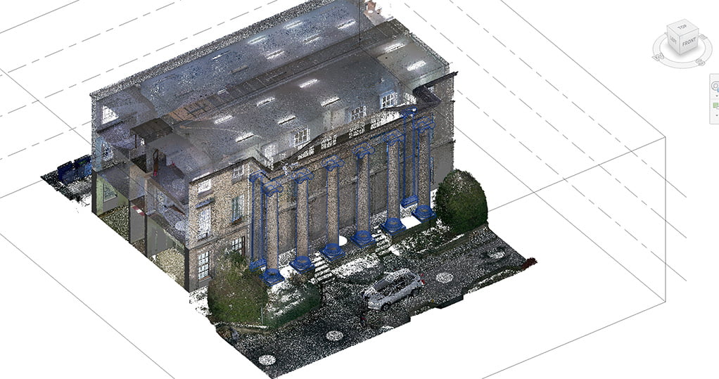
A point cloud survey is basically a 3D model of a building, consisting of millions of data points that are combined together to form survey data. These data points are collected with a laser scanner that captures spacial information in 3 dimensions.
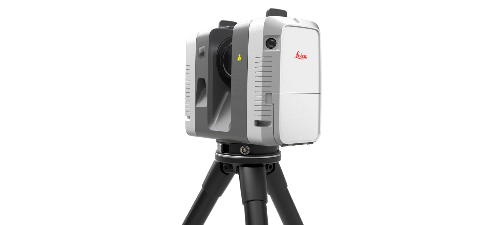
So how does this work? The scaning equipment beams out a laser in all directions, once the laser hits a surface it then bounces back to a sensor on the scanner. These points of information are used to calculate the distance, size shape and even colour of a surface, accurately creating a ‘point cloud’ survey data set.
Depending on the structure or surface that’s being surveyed, as well as which laser scanner you use, it’ll probably be necessary to move the scanner a couple of times to capture every element of the space. When you get every angle, you’ll have the most accurate 3D model of the object with even the smallest details, whether it’s a building or surroundings.
There are a couple of good reasons why a point cloud survey has become the industry standard. One of the main reasons is definitely flexibility, especially in terms of meeting the project requirements and tailoring the deliverables to suit your needs. Let’s take a look at some of the other benefits:
Compared to other surveying methods, the point cloud survey definitely emerges as a winner due to its accuracy and efficiency.

A point cloud is a valuable asset when working on various projects but it’s predominantly found great use in the architecture and construction industries. This kind of laser survey have become standard practice in these industries because of the benefits we’ve mentioned, especially when working on a project that includes renovation or when you need accurate data to present before/after and actual construction compared to the initial project.
When the technology first emerged, cloud point surveying was widely used to analyse terrains or in very specific use cases. But the technology has continued to develop rapidly, with smaller, cheaper and more user friendly equipment making the barrier to entry much lower. Recently, automated robot and drone options are beginning to appear on the market. Only the sky’s the limit when thinking how this technology will continue to evolve.
As mentioned above, there are plenty of advantages to a laser survey when renovating a building, or to scan the surroundings for a building that’s yet to be built. Many architectural projects often don’t go as planned, with small changes in the design necessary during construction. A point cloud survey can help to align the finished construction with the original architectural plans, creating accurate documentation of the real life structure.
There are various types of point cloud scanner, and each one has its advantages and disadvantages. At Scene3D we use a variety of top-of-the-range terrestrial laser scanners which use a lidar point cloud technology. Sometimes when there are details that can’t be captured from the ground, we also use drones depending on the requirements of the project.
A terrestrial laser scanner is fixed in one spot on the ground during each scan and can then be moved to capture another scan at every angle. As it’s fixed on a tripod on the ground, a terrestrial scanner captures extremely accurate data with no ‘wobble’ or movement during a scan when compared to drone or helicopter scanning, which can have a lower tolerance for accuracy. A terrestrial laser scanner also has a range of up to several hundred metres with high precision to capture every detail.
Laser scanning technology is more accurate compared to photogrammetry (using software to turn 2D photos into 3D data). So if you want to get as much detail and accuracy as possible, it’s highly recommended to hire a professional with lidar technology to do a point cloud survey to ensure the survey is carried out properly. Equipment is pricey, so it’s highly unlikely buying your own scanner will pay off for a few projects.

Point cloud data consist of various sets of data such as X, Y, and Z coordinates, RGB color codes, and brightness depending on the equipment used, they can even capture data about temperature. There are multiple free online software to view the data.
You can download and use TrueView which is a software developed by Autodesk specifically designed to view point cloud data. Be aware however, depending on the size of the project you may need a pretty powerful computer to view a point cloud in this way. A point cloud can also be processed into DWG / DXF files, but you’ll learn about point cloud file types later in this article.
Once all the point cloud survey data has been gathered, it will often need to be processed into a usable 3D model or 2D file. The information initially captured is raw and will need to be cleaned to only include the relevant data through a process called ‘registration’. The registered data-set is then processed ready to be converted into project specific deliverables..
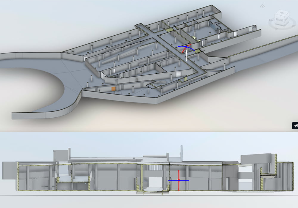
End result of converting a point cloud is usually a mesh or a CAD model, depending on the project requirements. Using, for example an architect may need accurate CAD drawings of a structure as it is in reality.
One of the biggest advantages to a point cloud survey is how malleable point cloud data is. Depending on project requirements, a point cloud can be converted into a wide range of 2D or 3D file types to suit your project requirements. At Scene3D the most common outputs we’ll provide for a client include:

Point cloud survey cost can vary significantly depending on key factors such as project scope and complexity. Every project has individual features that make it unique, so it can be tough to provide a ballpark figure without some information about the specifics. To help explain point cloud survey costs in more detail, we’ve written an article on this topic. Our point cloud survey pricing article includes helpful information such as the main factors that affect the price, some example pricing, and what information a provider will need to give you a quote.
If you’d like to take a look you can Read Our Point Cloud Pricing Article Here.
Working on a project and you need a point cloud survey? Scene3D have got you covered. Talk to our experts and get a free quote today with no obligation. To help us provide you with an accurate quote we just need a few key pieces of information:
Once we have the above info we can provide a point cloud survey cost for your project in less than 24 hours.