Address
Studio 03
SUM Studios
1 Hartley Street
Sheffield
S2 3AQ
[email protected]
0114 399 1023
Today, capturing the shape of a physical object, building, or environment in three dimensions can take remarkably little time. A scanner can collect millions of measurements and transform them into a detailed digital representation that can be explored, measured, documented, and used long after the original scan.
But 3D scanning did not begin as the fast, portable, and highly capable technology we know today. Its development spans decades of experimentation in optics, lasers, computing, photography, and digital modelling.
Understanding that journey helps explain why 3D scanning has become such a valuable tool across architecture, engineering, construction, heritage preservation, manufacturing, and digital experiences.
The foundations of modern 3D scanning began taking shape in the latter half of the 20th century.
Early systems attempted to determine the three-dimensional geometry of physical objects without relying entirely on manual measurements. This was a significant challenge. Capturing an object’s width and height was relatively straightforward, but accurately recording depth and complex surface geometry required new methods.
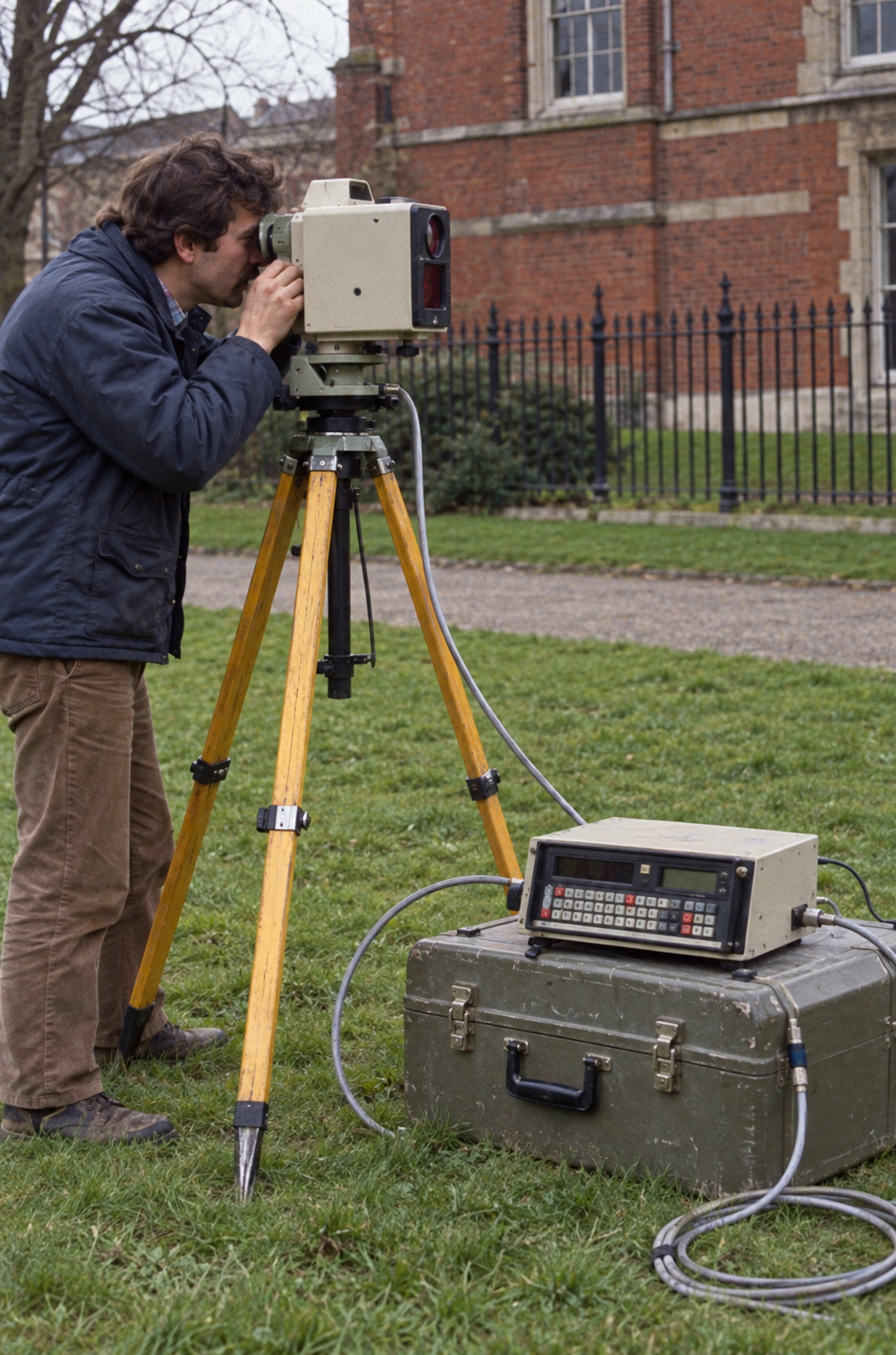
During the 1960s and 1970s, researchers experimented with technologies involving light, cameras, and projectors to gather spatial information. These systems were far removed from today’s portable scanners. They could be slow, expensive, and highly dependent on controlled conditions.
Even so, they introduced an important idea: the geometry of the physical world could be captured as digital data.
A major shift occurred as laser technology became increasingly incorporated into 3D measurement.
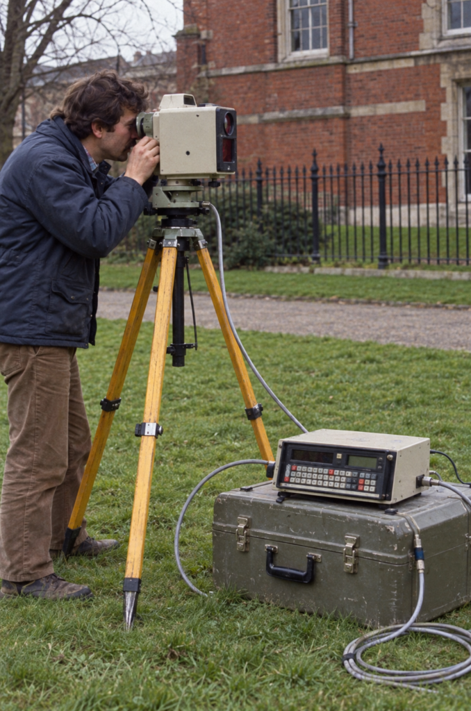
Rather than attempting to reconstruct geometry from contact-based measurements or conventional photography alone, laser scanning systems could determine the positions of points on an object’s surface.
By projecting laser light and analysing its return or position, scanning systems could gather depth information with increasing precision.
This opened new possibilities for capturing complicated shapes that would be difficult and time-consuming to document manually.
However, early laser scanning systems still had significant limitations. Equipment could be bulky, computing resources were expensive, and processing large quantities of spatial information required substantial time.
The potential was there. The surrounding technology simply needed to catch up.
During the 1990s, improvements in computing began changing what was possible.
Computers became faster. Digital storage has improved. Software for processing geometric information became more capable. At the same time, scanning hardware continued to advance. This combination made 3D scanning increasingly useful outside highly specialised research environments.
Industries such as manufacturing and engineering began using scanning for tasks including dimensional inspection, quality control, product development, and reverse engineering.
Instead of manually recreating the geometry of an existing component, professionals could capture its physical form and bring that information into a digital workflow.
This was an important transition: 3D scanning was becoming less of an experimental technology and more of a practical professional tool.
Another major development was the growing adoption of LiDAR, or Light Detection and Ranging.
LiDAR systems measure distance using laser pulses, enabling them to collect large quantities of spatial data about objects and environments. The resulting measurements can form a point cloud: a collection of individual points representing surfaces in three-dimensional space.
For architecture, surveying, engineering, and construction, this was transformative. Buildings, infrastructure, industrial facilities, and landscapes could be documented at a scale that would have been extremely difficult to achieve using traditional measurement methods alone.
Rather than recording selected dimensions individually, professionals could capture a far more comprehensive digital record of a space.
As computing accelerated during the 2000s, the value of 3D scanning expanded with it. Scanners became more capable, while software improved at registering multiple scans, cleaning point clouds, generating meshes, and integrating captured data into other professional applications.
The relationship between scanning and CAD also became increasingly important. A physical asset could be scanned and its geometry used as a reference for design, documentation, analysis, renovation, or fabrication.
For architects and engineers working with existing buildings, this helped reduce reliance on incomplete drawings or extensive manual site measurements. For manufacturers, it provided increasingly efficient ways to compare physical products against their digital designs.
3D scanning was becoming part of a broader digital workflow rather than an isolated measurement process.
Lasers were not the only technology changing 3D capture. Photogrammetry—the process of extracting measurements and three-dimensional information from overlapping photographs, also developed rapidly as digital cameras and computing improved.
By analysing common visual features across multiple images taken from different positions, software can estimate depth and reconstruct three-dimensional geometry.
Photogrammetry brought a different set of advantages. Depending on the project, it could provide highly detailed visual textures alongside geometry and could be performed using cameras rather than dedicated laser equipment.
This helped expand 3D capture into fields such as cultural heritage, archaeology, visual effects, gaming, mapping, and digital content creation.
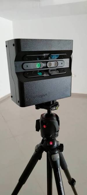
One of the biggest changes in recent years has been the shrinking size of scanning technology. Equipment that once required specialised setups can now be available in handheld or mobile formats. Advances in sensors, cameras, processors, and software have made it possible to capture spaces and objects with far greater flexibility.
Some smartphones and tablets have even incorporated depth-sensing capabilities, bringing basic forms of spatial capture into consumer devices. The significance of this shift goes beyond convenience.
When technology becomes easier to transport and operate, it can be used more frequently and in more environments. A building, retail space, construction site, artefact, or interior no longer needs to be approached as a highly specialised scanning project in every case. 3D capture can become part of everyday documentation.
Perhaps the most important evolution is not simply how 3D data is captured, but what happens after capture. A scan can become the starting point for much more than a static 3D model.
Spatial data can contribute to digital twins, BIM workflows, virtual environments, facility documentation, asset management, construction monitoring, and immersive experiences. This represents a fundamental change in the role of scanning.
Originally, the challenge was simply to capture physical geometry accurately. Today, the greater opportunity lies in connecting that captured reality with useful digital information.
A scanned environment can potentially be revisited without returning to the physical site. Measurements can be checked remotely. Existing conditions can be documented before renovation. Spaces can be preserved digitally before they change. The scan becomes a lasting digital reference.
The evolution of 3D scanning is continuing alongside developments in artificial intelligence, robotics, cloud computing, augmented reality, and spatial computing.
Automated systems can increasingly help classify objects within captured environments, process large datasets, and turn raw spatial information into usable models.
At the same time, faster cloud processing and more accessible hardware are making sophisticated 3D workflows available to a wider range of businesses.
The future of scanning is therefore unlikely to be defined by a single type of scanner. It will be shaped by how easily the physical and digital worlds can be connected.
The journey from experimental optical systems to today’s detailed digital environments has taken decades—but the direction has remained consistent: capturing reality more accurately, efficiently, and usefully.
The technology behind 3D capture has changed dramatically. What matters now is what your business can do with it.
Scene3D helps turn real-world spaces into detailed digital experiences that can support documentation, visualisation, remote access, marketing, and project workflows.
Whether you need to capture an existing property, create an immersive representation of a space, or preserve accurate visual information for future use, Scene3D can help bridge the gap between the physical environment and its digital counterpart.
Discover what your space can become with Scene3D.