Address
Studio 03
SUM Studios
1 Hartley Street
Sheffield
S2 3AQ
[email protected]
0114 399 1023
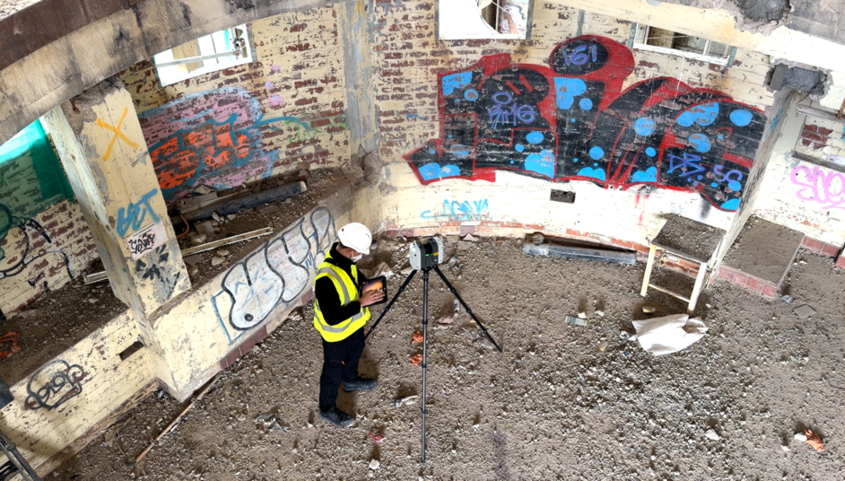
A point cloud survey may take only a few hours or a few days on-site, but the site visit is only the beginning of the project. Many clients see laser scanners capturing millions of measurements and assume the drawings or Revit model can be produced almost immediately. In reality, most of the work happens after the survey team has left the site.
The point cloud survey process involves several technical stages that transform raw scan data into accurate, reliable deliverables that architects, engineers, contractors and building owners can confidently use.
Understanding what happens behind the scenes helps explain why quality survey providers focus on careful processing, quality assurance and validation rather than simply collecting scan data.
During the site visit, laser scanners capture millions or even billions of measurements from multiple positions throughout the building or site. These measurements create individual point clouds that accurately represent the surrounding environment.
Surveyors also collect photographs, control points, site notes and measurements where required. The goal is to capture enough information to ensure complete coverage while minimising areas hidden from the scanner.
Although this stage is highly visible, it often represents only a fraction of the total project effort.
Once the fieldwork is complete, each individual scan must be combined into a single coordinated point cloud.
This stage, known as point cloud registration, aligns all scans into a single, accurate coordinate system. Depending on the project, registration may use survey control, targets, cloud-to-cloud matching or a combination of techniques.
The registration process is critical because even small alignment errors can affect dimensions throughout the project.
Experienced survey professionals carefully verify registration accuracy before moving to the next stage, ensuring that every scan fits together correctly.
After registration, the data is reviewed and processed.
Although laser scanners capture enormous amounts of information, not every point is useful. Temporary objects, passing people, moving vehicles, construction equipment and other unwanted data may need to be removed where appropriate.
Processing can also involve organising scan data, optimising file sizes and preparing the point cloud for CAD or BIM software.
The aim is not to change the measured information but to produce a clean, organised dataset that supports efficient design work.
This stage is an important part of the overall point cloud processing workflow.
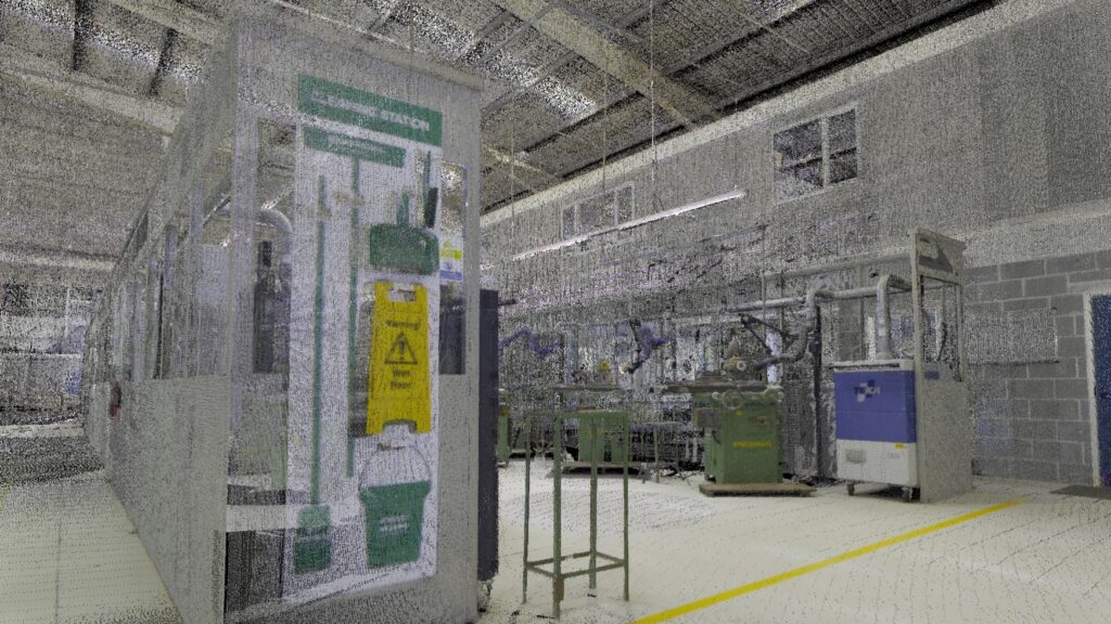
Professional survey companies spend significant time checking the processed data before producing any drawings or models.
Quality assurance may include:
These checks reduce the risk of errors being carried into design or construction.
Clients often never see this work, but it is one of the most valuable parts of a professional survey service.
For more information, read our article on laser scanning quality.
If the project requires 2D deliverables, technicians begin the Scan-to-CAD process.
Rather than automatically converting the point cloud into drawings, experienced CAD technicians interpret the scanned information and create accurate plans, elevations, sections and other required drawings.
This manual interpretation is essential because the software cannot reliably determine every wall, opening, beam or structural feature without human judgement.
The resulting drawings are organised according to the agreed project standards and checked before delivery.
You can also learn more about our measured survey deliverables.
Where Building Information Modelling is required, the project moves into the Scan to Revit process.
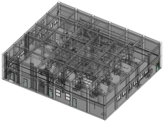
Modellers use the registered point cloud as a reference to build an intelligent Revit model that accurately represents the existing building.
This includes creating walls, floors, roofs, structural elements, doors, windows, and other components in accordance with the required Level of Information Need or project specification.
Unlike the point cloud, the Revit model contains editable BIM objects that designers and engineers can use throughout the design process.
If your project requires BIM deliverables, see our guide to preparing a Revit survey brief.
Before files are issued to the client, they undergo an internal review.
This final stage confirms that:
A structured review process helps ensure clients receive consistent, reliable deliverables that can be used immediately within their design workflow.
One of the most common questions clients ask is why survey deliverables take longer than the site visit itself.
The answer lies in the amount of technical work required after capture.
Several factors influence turnaround time, including:
A small office floor may require only a few days of processing, while a complex industrial facility or historic building could involve weeks of careful registration, modelling and quality checking.
Fast delivery is valuable, but accurate deliverables that reduce design risk provide far greater long-term value.
When comparing survey quotations, it is worth asking what happens after the scanners leave the site.
Some providers focus primarily on data capture, while others include comprehensive registration, quality assurance, CAD production, BIM modelling and final review as part of their service.
Understanding exactly what is included helps you compare quotations fairly and ensures you receive deliverables that are accurate, complete and ready for use.
At Scene3D, every project follows a structured laser scanning process that takes raw point cloud data through registration, processing, quality assurance and professional CAD or Revit production. The result is survey information that architects, engineers and contractors can trust throughout the life of their project.
Ready to discuss your project? Contact Scene3D to learn how our point cloud survey process delivers accurate CAD drawings and Revit models that support confident design and construction decisions.