Accuracy and Efficiency

LIDAR Survey 

Improve efficiency and eliminate errors with a LIDAR measured survey. LIDAR surveying quickly captures detailed data from your site, ensuring your project moves smoothly and without costly errors.

To make sure you are free from slow downs and inaccuracies, deliverables can be tailored to meet your individual requirements. Files can be delivered in a range of 2D or 3D outputs.

Say goodbye to delays and errors.

Accurate as-built data capture

What is a LIDAR Survey?

Fast becoming the industry norm, LIDAR Survey, or a Point Cloud survey, seamlessly gathers all the geometric and colour information of a building’s structure, even capturing the most small and intricate features. This dramatically improves a survey’s accuracy, eliminates errors and reduces the on-site time required to survey a property. 

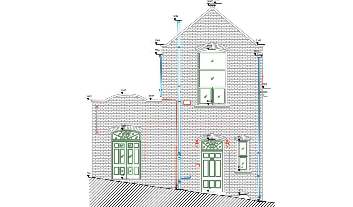
Often completed for verification purposes, a LIDAR measured survey can help identify differences between the original plan and actual construction – they can also be used for measuring floor plans, elevations, sections, etc.

A high standard, effective and efficient measured survey

Why Use a LIDAR Survey?

LIDAR Surveys are increasingly popular due to their ability to provide detailed and accurate measurements of physical spaces and structures. A point cloud survey dramatically reduces the number of assumptions and generalisations, to ensure a smooth and efficient project.

Datasets captured in a point cloud survey can produce a range of deliverables tailored to suit your project, or client needs.

Unmatched Accuracy

  • The LIDAR scanner captures millions of data points to create a highly precise 3D model of the surveyed area.
  • Measures intricate details and complex geometries that traditional surveying methods may miss.
  • Reduces human error, ensuring measurements are accurate

Wide Range of Output Options

  • Can be adapted to various formats, ensuring compatibility with other software tools and platforms. 
  • Depending on the project’s needs, the level of detail can be adjusted. 
  • The data can be used in many different ways, from creating basic visual models to complex simulations.

Efficiency and Time Savings

  • Collects comprehensive spatial data in a fraction of the time it takes for traditional surveying.
  • Allows for rapid data collection, minimising disruption to the surveyed site.
  • Speeds up the project timeline by providing immediate, actionable data.

Versatile Applications

  • Can be used for both indoor and outdoor surveys, adaptable to any environment.
  • Suitable for a wide range of industries, including construction, heritage preservation, manufacturing, and urban planning.
  • Supports various project phases, from initial planning and design to renovation and maintenance.

Making the data work for you

Output Options:

We’ll provide you with accurate and tailored outputs to meet your project requirements. The data can be provided in a variety of outputs, most commonly:

  • CAD Drawings (.dwg, .pdf)
  • Revit file (.rvt)
  • Sketchup file (.skp)
  • Point Cloud (.e57)
  • And others

Trusted by

What’s the Process?

The 4 steps to getting a LIDAR Survey

1. GET A QUOTE

The cost of a LIDAR Survey is dependent on the size and scale of your site or building project. Scene3D will assess your project and requirements in order to provide an accurate quote – no hidden costs.

2. AGREE SURVEY DATE

Once the quote has been accepted we’ll look to schedule a date to conduct the LIDAR Survey at your earliest convenience. We have several technicians so can usually be available to suit your schedule.

3. ON-SITE DATA CAPTURE

Our technicians will arrive at the scheduled time & place to conduct your LIDAR Survey. All data capture of your site will be undertaken in a quick and efficient manner, making sure that all the required details are captured.

4. DELIVERY

Once our team have finished assembling the point cloud, we’ll then convert the raw data into your required deliverables. This can be in 2D outputs such as a DWG floorpan, a 3D output such as a Revit file or a mix of 2D & 3D files.

Solutions for all your project needs

Ways we can help

Building surveys

Gives a precise and exact data-set of all the elements of a building, including the structure and architecture.

Topographic surveys

Provides an accurate representation of natural and manmade features within a defined specified area.

Drone surveys

Captures detailed data and images from areas that are too expensive, time-consuming or risky to access.

Visual reference

Matterport Virtual Tours have exceptional visuals that can be used for off-site referencing on any smart device.

BIM models

Building Information Modelling (BIM) is a digital representation of the physical characteristics of a building.

Let’s work together

Get a quote

Talk to our experts and get a free quote today with no obligation. To help us provide you with an accurate quote we just need a few key pieces of information:

Or click here to learn more about our virtual tours for business.


Please enable JavaScript in your browser to complete this form.

Case Study

LIDAR Survey in Sheffield

Work completed:

Interior Point Cloud Survey

100%

Exterior Point Cloud Survey

100%

Scene3D were commissioned to undertake a LIDAR Survey of a commercial property in Sheffield. The owner of the property plans to redevelop the building, so requested Scene3D to conduct an external topographical, and internal survey of the property in its current condition.